
So nice in Nice!
A visit to Nice and surrounding areas, with a focus on rail travel
( As The Stranglers once sang).
Hi Everyone,
We're back from a relaxing couple of weeks in and around Nice, which included some rail travel.
Nice is well served with direct connections to Paris on the TGV network, Italy via Ventimiglia, as well as some local lines.
The city also has three tram lines, Line One which loops through the city in a U shape, Line Two crosses under the city to the airport, and Line Three, from the airport line through the suburbs on the western side of town. The trams have an interesting feature which is reasonably common in Europe, they operate under wire for part of the journey, but in the city centre rely on battery propulsion which means no overhead cluttering the streetscape.
A separate railway commences a few blocks past the main railway station, and traverses some interesting country into the mountains northeast on Nice to Digne les Bains, the Metre gauge Chemin de fer du Provence, or CP, and also known as the Train des Pignes.

An overview of the tram and rail lines around Nice, and surrounds
Let's start with the trams.
The current Tram network is approximately 53 km long, and operates a fleet of Citadus trams, similar to those we have in Melbourne, Sydney and Adelaide.
Line 1 is above ground, and is the U shaped line mentioned above, coming from the terminus and depot at Henri Sappia, passing south near to both the CP and main SNCF railway stations. Shortly before entering Place Masséna, the pantographs are lowered, and the tram continues through the square, and swings left near the fountain of the sun (Fontaine du Soleil), and onto grassy right of way flanked by Boulevard Jean Jaurès, and the old town of Nice (Vieux Nice).

Two Line One trams meet on Boulevard Jean Jaurès. The Henri Sappia bound tram has lowered its pantograph, while the Hospital bound tram has raised its. Since this photo was taken on our last visit in 2019, the overhead has been removed from this section as well.
There are short sections of overhead at the tram stops in this section, but it doesn't resume continuously until the line reaches the north side of yet another pretty colonnaded square, Place Garibaldi.
The line continues in a roughly northerly course on a mix of street, grassed and concrete right of way, before arriving at the terminus of Hôpital Pasteur, adjacent to the hospital. Line one first opened in 2008.

A Line Two tram sits in the sun at Port Lympia, and will shortly depart to the left, towards Grand Arénas.
The 11 km long Line 2 starts at Port Lympia, Quay Napoleon, and on departing the terminus heads east into a 3km long tunnel, passing under the city. Its first stop provides an easy interchange with Line 1, just a short walk across Place Garibaldi. All the underground stops have escalators and lifts and are very easy to navigate, with ticket dispensing machines, but no barriers to validate before travel, like elsewhere on Line One, that's done on the trams themselves.
Two stations further on, there's another easy interchange with Line one, and two stations further on, emerges into the daylight a block back from the beach to continue its journey east to the junction point of Grand Arénas. Here the line splits in two, left to the Airport, right to CADAM, the administrative centre for the Alpes - Maritimes Region.

Port Lympia, with a recently arrived tram on the left, as the one on the right pulls back into the platform.
Every second tram from Port Lympia goes to either destination.
Line Three also joins the party here.
Along with Line two, it connects to terminals one and two at Nice International Airport, however line three follows the Var river past CADAM, and services residential areas, the large sporting stadium, and terminating at Saint Isidore.
Both lines Two and Three were opened in 2019.
It's a great, frequent service to use, we purchased tickets valid for 10 trips at one of the underground stations, which are also valid for use on the extensive bus network.

Jean Médecin Line Two underground tram station, which is one of two interchange points with Line One.
Chemin de fer du Provence
This metre gauge line stretches from the CP station, some 150km into the mountains to Digne les Bains. The line dates back to the 1880s, 20 or so years after Nice and surrounds became part of France. It was once part of a far wider network that served the communities inland from the coast, where the main Paris - Lyon - Mediterranean railway built their standard gauge railway linking via Marseillaise into Italy.
It's the last surviving section of a railway system that once spanned nearly 900km!
For an in-depth history of the system, I'd suggest visiting Roger Farnworth's blog, it covers this, and many other fascinating railway and tramway systems, with great vintage postcards, and contemporary maps and photos.

Today, the line is passenger only, and operates a series of rail motors, the most modern being four sets constructed in 2010, one set being scrapped as the result of an accident. Other rail motors in service date from 1972, and resemble a double ended bus on four wheels, which seem to run most of the commuter services.
Another feature of the line, which has assisted with its survival beyond the commuter fringe is a heritage steam service between Puget- Théniers and Annot. We travelled on this train in 2019, which was hauled by a Portuguese Mallet articulated loco, a big tick from me!

Entreveaux on the Train des Pignes. The interesting wheel arrangement of the Mallet articulated loco, and the citadel perched high above.

The former Gare Sud, now preserved as a market.
When constructed, the line originally had its station on Avenue Malausséna - a continuation of Avenue Jean Médecin which carries tram Line 1 down to Place Masséna.
In the 1990s, a funding arrangement battle with the Nice Council saw the station closed, and a new station built a few blocks back, while the beautiful Gare Sud (south) was left to ruin, and slated for demolition. Fortunately, it survived, and has been turned into a market, keeping its stunning heritage listed facade. The frame of the train shed that once covered the tracks has an even more interesting history, it was constructed for the 1889 Paris Universal Exposition to house the displays of the Russian and Austro - Hungarian empires.

The 1990s built station is fairly utilitarian compared to its predecessor!
The 'new' station reminds me that even the French are capable of ordinary architecture, it reminds me of Hargreaves St. Mall in Bendigo when it was first built!
The line travels at close quarters through the suburbs, before entering the first of several tunnels. It reappears in the next valley, still climbing, and works around the head of a valley before entering another tunnel.
Another valley, and eventually a descent near the Stade de Nice, and down beside the river Var at Saint Isidore.
We passed the main railway workshops and maintenance facility at Lingostiére, and from there on the line then more or less followed the course of the river. First on flats, then, as the valley steepened, on embankments tunnels and retaining walls to keep the line out of harms way.The further in from the coast we went, hilltop villages became more common, built high up away from water borne disease, and Saracen raiders.

We eventually came to the plane tree lined town of Annot, where the steam loco and it's cars are based and cared for, before entering a really steep and rocky section of the line.
The road splits in two, with southbound traffic crossing the river and passing through a tunnel, before rejoining the railway, and northbound traffic on the other side of the gorge.
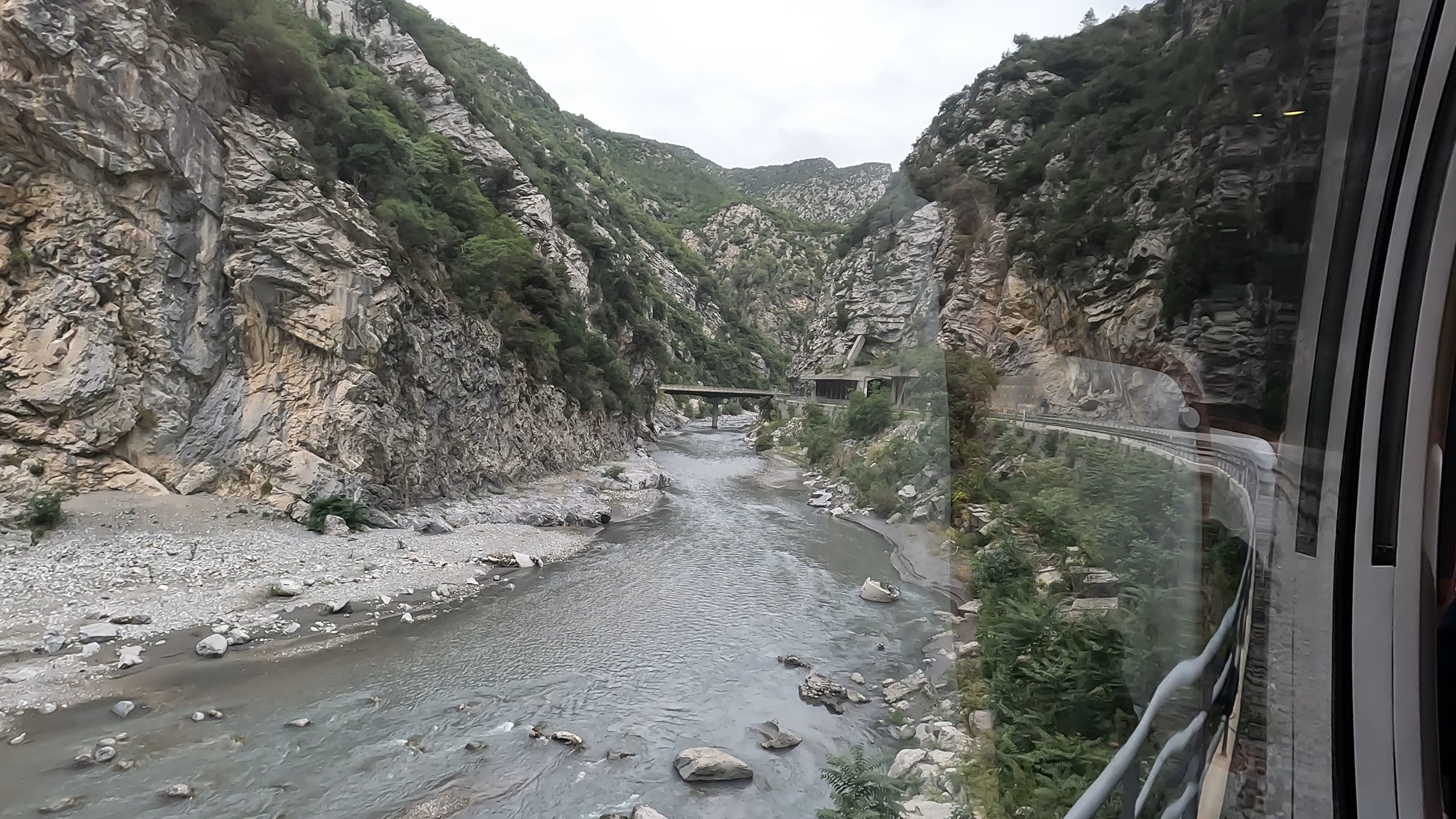
Plenty of rugged scenery to be had on this journey!
The spectacular scenery continued until we reached another widening of the valley, and the station of Entreveaux, outside the gates of the 11th century walled town.
This was our destination for the day.
We'd stopped there for a short time on the steam trip, and I was rather taken with the citadel perched high above the medieval walled town, with its drawbridge across the Var.
The route featured in that well known French travel show, Le Tour de France in 2020, with some pacing of the train by the Peloton, as well as the helicopter flyover of the landmarks, which the citadel is certainly one. It's perched 160m above the town, on a sheer cliff to the north, and steep drops on the other sides.Its location on a rocky outcrop and narrow point of the river gave Entreveaux a very strategic position, on the border of France and Savoy (part of modern day Italy until 1860 when the region, including Nice and Monaco passed to France).

The walled town of Entreveaux. The river Var passes around the outside, with the main entrance being a small drawbridge protected by fortifications. The citadel, and its rampart protected walkway dominates the hill overlooking the town, and the gothic cathedral can be picked out by its square tower.
Back down in the village, it was very quiet, narrow medieval streets with an informal layout matching the geography, a main square with a couple of restaurants, and another smaller square outside the small gothic Cathedral. Dating from 1620 the structure is very simple, but the decorations inside were stunning. A beautiful blue ceiling with fleur de lys dominates the knave.

The beautifully decorated cathedral
The climb up to the citadel was hard work, but well worth the effort, we took it slow and steady, and passed others who hadn't managed to reach the top.
Once at the summit, the facilities were fairly limited, stone beds in the quarters, and minimal comforts, a few fireplaces, but certainly not somewhere I'd sign up for a winter! The views though…

Both north and south along the valley and surrounding mountains were very impressive!
After lunch, we wandered back over to the station, and waited for our train, the same rail motor, this time busy with school students who dropped off as we got closer to Nice.
We walked back to the tram stop, and caught Line One back to Place Garibaldi, near where we were staying.
I’m hoping next time we visit Nice, a trip all the way to Digne by train is possible!
Local train services

Nice has an extensive local standard gauge rail service, stretching into Italy via Monaco, into the mountains into Italy via Breil, as well as through Cannes to Marseillaise, and beyond. There's also another branch into the hills to Grasse, the home of French Perfume.
We caught a few local trains this trip, including making use of a Marseilles bound TGV duplex to travel from Nice to Antibes. Our return journey, and the others we took to Menton, Beaulieu-sur-Mer and Ventimiglia were in the double decked Alstom Z26500 class trains. These date from around 2005, and are a common sight across all the French regions.
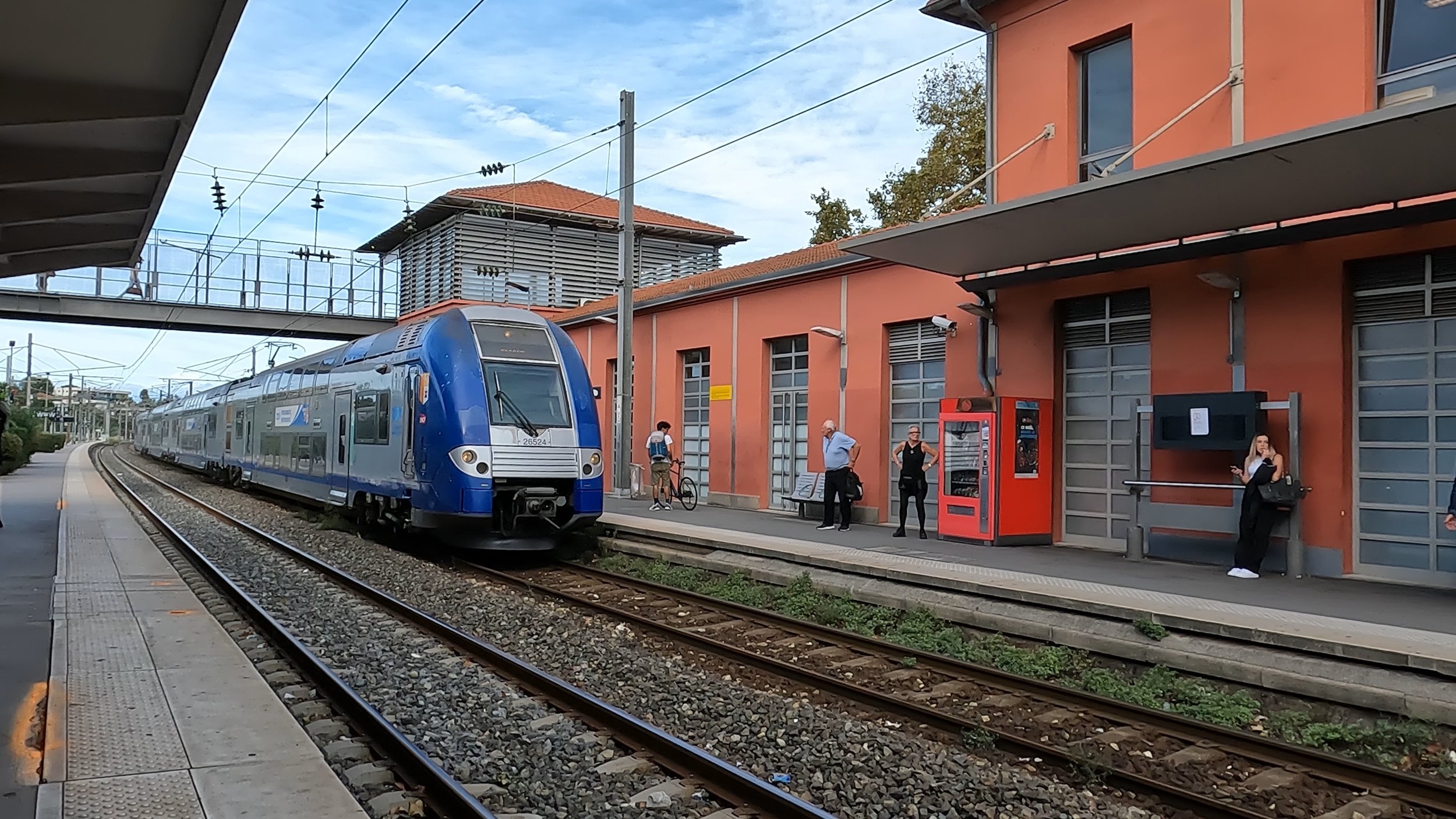
A train for either Les Arcs, or Grasse pulls into Antibes.
Services operate from Les Arcs Draguignan and Grasse through to Ventimiglia, and return. Ventimiglia is an interchange for trains going to Milan, and onward to other points in Italy.

A TrenItalia intercity service, and Provence - Cote d'azur train sit at Ventimiglia, the interchange point for the two systems.
While it’s within the European Union, returning from Ventimiglia there was a passport check, so it certainly pays to keep them on you, even on day trips.
Once out of Nice, the lines hug the coast giving some spectacular views over the Mediterranean, punctuated by frequent tunnels, particularly towards Italy. Tiny rocky beaches, harbours with expensive boats, and large houses all dot the coast, with frequent stops at the stations to service the communities.

Typical of the railway between Nice and Ventimiglia, the line hugs the coast, with narrow beaches between the railway and the water. This Nice bound train is approaching Villefranche sur Mer, another medieval town literally over the hill from Nice.
Monaco Monte Carlo has a large underground station, deep in the hillside which replaced the previous station of the same name. The new station, and its 460 metre long tunnel opened in 1999, putting the entire length of railway through the principality underground - the ultimate grade separation?

I’ll wind it up there, but if you’re interested in any of the places we visited on our stay - Antibes, Menton, St Jean /Cap Ferrat, Beaulieu-ser Mer, Eze or a little off the beaten track, the tiny village of Gorbio, please let me know!
Thanks again for reading.